TALK TO AN EXPERT
+977-9851040420
Highlights
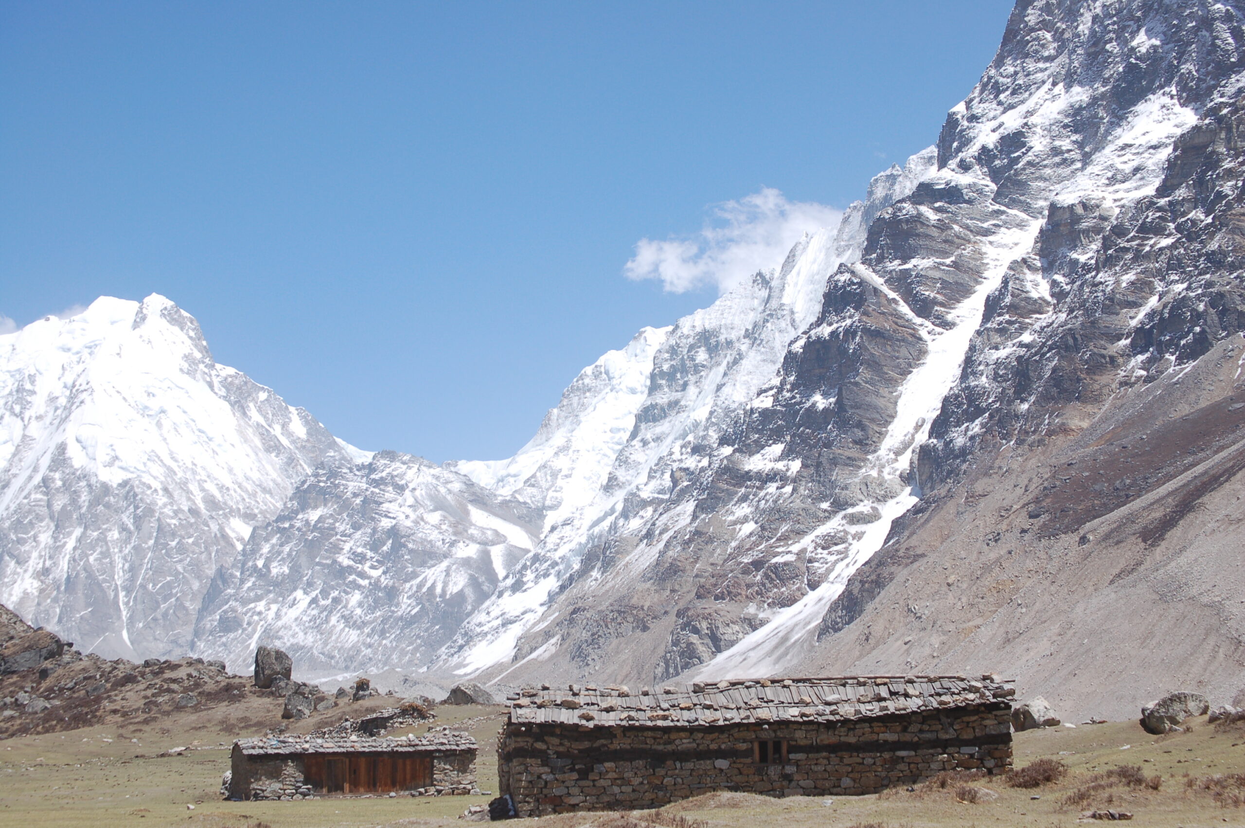
The Lower Dolpo Trek, a mesmerizing adventure that promises breathtaking landscapes, ancient culture, and unparalleled tranquility. Nestled in the remote corners of Nepal, Lower Dolpo offers an escape from the hustle and bustle of modern life into the serene embrace of the Himalayas. Lower Dolpo, situated in the northwestern region of Nepal, is a hidden gem waiting to be explored. Renowned for its rugged terrain, pristine lakes, and towering peaks, this remote wilderness is a paradise for adventure enthusiasts and nature lovers alike. The journey typically begins in Juphal, where adventurers are greeted by the awe-inspiring views of the Himalayan range. From there, the trail winds its way through quaint villages, lush forests, and cascading waterfalls, eventually leading to Dunai, the administrative headquarters of Dolpa district. Beyond its natural beauty, Lower Dolpo is steeped in rich cultural heritage. The region is home to indigenous communities such as the Dolpo-pa, who have preserved their ancient traditions and way of life for centuries. Travelers have the opportunity to interact with locals, visit monasteries, and partake in traditional ceremonies, gaining insight into the unique cultural tapestry of the Himalayas. Lower Dolpo is a haven for biodiversity, boasting a diverse array of flora and fauna. From elusive snow leopards and Himalayan blue sheep to exotic bird species such as the Tibetan snowcock and the Himalayan monal, the region offers ample opportunities for wildlife enthusiasts and photographers to capture the beauty of the natural world. The optimal time to experience the Lower Dolpo Trek is during the spring (March to May) and autumn (September to November) seasons when the weather is mild, and the skies are clear, offering unparalleled views of the Himalayan peaks. While the Lower Dolpo Trek does not require technical climbing skills, it is essential to be in good physical condition and adequately prepared for high-altitude trekking. Engaging in regular exercise, acclimatization, and proper gear selection are crucial for a safe and enjoyable trekking experience.
The Lower Dolpo Trek beckons adventurers to embark on a journey of discovery, offering an unparalleled blend of natural beauty, cultural richness, and adventure in the heart of the Himalayas. From the rugged landscapes and ancient monasteries to the warm hospitality of local communities, every step of the trek unveils new wonders and experiences, leaving an indelible mark on the hearts and minds of those who dare to explore its pristine wilderness. Embark on the Lower Dolpo Trek and immerse yourself in the timeless allure of one of Nepal’s best-kept secrets, where every moment is a testament to the beauty and majesty of the Himalayan landscape. Embark on an unforgettable adventure to Lower Dolpo and immerse yourself in the pristine beauty, rich culture, and awe-inspiring landscapes of the Himalayas. Whether you seek adventure, cultural immersion, or simply a peaceful retreat into nature, the Lower Dolpo Trek promises an experience like no other, leaving you with memories to cherish for a lifetime. For those seeking guidance and logistical support, Clear Sky Treks as a trekking agencies and local guides offer organized tours and trekking packages to Lower Dolpo. These experienced professionals provide valuable insights, logistical assistance, and ensure a seamless and enriching trekking experience for travelers.
Gallery
Itenary
Duration: 23 Days
Max Altitude: 5360 m
Difficulty: Hard
Cost: USD $2150.00 to USD $2700.00 Per person
Country: Nepal
Activity: Trekking in Nepal
Starting Point: Kathmandu
Ending Point: Kathmandu
-
1: Arrive Kathmandu (1300m) BB
Welcome to Kathmandu, the capital city of the Himalayan kingdom of Nepal.You will be met on airport and transferred to your hotel. After the arrival, the group will be formally introduced to Guide for the activities over the next few days. One should pay attention in particular to the safety aspects of the briefing. Any questions or doubts should be asked and clarified at this time. We check your insurance details and other requirement for your trekking.
-
2: Special permit arrangement & Kathmandu Sightseeing. BB
After breakfast, we start an interesting tour around Kathmandu. Escorting by an English speaking guide be, try to give them a full taste of our vivid culture image and an enchanting manner of its people. In our sightseeing tour we go to Monkey temple Swayambhunath, Pashupatinath and Kathmandu Durbar square. Durbar Square: -This complex of palaces, courtyards and temples, built between the 12th and 18th centuries, used to be the seat of the ancient Malla kings of Kathmandu. An intriguing piece here is the 17th century stone inscription set into the wall of the palace with writings in 15 languages. The Durbar square, protected as an UNESCO world Heritage site, is the social, religious and urban focal point of the city. There are also museums inside the palace building. There is an entrance fee of Rs.250 for foreign visitors. Your ticket to the Square entitles you to visit all the museums. Swayambhunath, 6.5 kilometers west of Kathmandu, situated on a hillock,
this 2000 years old Stupa is the world’s most glorious Buddhist shrine and is surrounded by several small pagodas. The main temple is capped by a pinnacle of copper gilt and is painted on the four sides with all seeing eyes of Lord Buddha. Pashupatinath, dedicated to Lord Shiva, is the holiest and most famous Nepalese temple. Situated 5 kilometers northeast of Kathmandu on the bank of the sacred Bagmati River, it is an impressive pagoda style structure with gilt roof and richly carved silver doors. It has bathing and cremation ghats, which are of absorbing interest to the tourist, particularly in the mornings and on festival days. -
3: Kathmandu – Nepalgunj fly (90 min) BLD
After breakfast drive to airport and fly to Nepalgunj. It is in the Terai near the Indian border. We spend rest of our days exploring the city. Overnight stay at the hotel.
-
4: Nepalgunj to Juphal fly then JUPHAL-DUNAI (2109m/ 2 ½ -3 hours) BLD
The flight to Dolpo from Nepalgunj is short but exciting, and the landing a heart –stopping affair typical ofso many grass –strip landings in upcountry Nepal.The airstrip at Julphal is on a hillside shelf high above the river at an altitude of 2354 metres (7720ft), with the few houses of the village tucked just below overlooking the deep Thuli Bheri valley.The trail to Dunai descends past the houses heading roughly south-east through fields and in about 10 minutes comes to the large village of DANGI BHARA built on terraces looking upvalley.
Pass through Dangi Bhara and continue between more fields of maize (sweetcorn). Cross a stream and about one hour from Juphal reach the bed of the valley at a group of houses protected from evil spirits by a crudely carved wooden figure placed at the upstream end of the village.these effigies are known as dok-pa,and a number of Dolpo villages and bridges are guarded by them .This particular settlement is KALA GAURA.The trail now remains close to the river on its south bank all the way to Dunai.There’s a short narrowing of the valley ,beyond which you come to ROOP GHAR with its water mill and simple lodge by a tributary stream.Beyond the stream the trail soon passes on the opposite bank the entrance to the Suli Gad valley (the river is also known as the Phoksundo Khola)which leads north in three days to Ringmo and the Phoksundo Lake.An army camp can be seen on a level meadowland raised above the Thuli Bheri overlooking this confluence of valleys.
Now the main valley curves to the right and the trail crosses broad flat meadows fringed with pine.Small fields appear ,while the valley opens ahead with snow –dusted peaks in the distance.In about 2 ½ hour from Juphal ,with a large complex of hospital buildings seen on the opposite bank ,go through an entrance kani and moments later enter the district headquarters of DUNAI (2109m/6920ft)
Dunai is a large village with a paved street lined with houses, several shops and a lodge o9r two.In the center stands a statue of King Mahendra .The village has a school ,police check-post and government offices.On the opposite bank ,crossed by a steel suspension bridge ,stands the district jail;,.At the south –eastern end of the village a pleasant campsite (with shower)is situated to the rear of the Blue Sheep Inn,with an apple orchard behind that.
-
5: DUNAI –TARAKOT(2600m/ 5 hours) BLD
The continuing route remains on the south bank of the river heading upstream on a good trail.In 15 minutes pass a group of houses and a grov of pomegranates.A little beyond this trail the way leads past a small ,flat –roofed water mill.Soon after the trail forks.Upper Dunai can be seen perched high above to the right ,but our route drops left to cross the river on a wooden bridge and then heads right to continue upstream.
Rising a little the way soon eases again when a tributary valley (attractive with pine-clad levels) enters from the right .Our main valley curves left towards a gorge where the trail climbs steadily above the river. Topping a rise fine views show the route ahead before the trail descends to river level once more where cannabis grows in open patches. When the way divides take the right –hand option,cross a minor stream on a rustic timber bridge with carved posts,and soon after go along acauseway constructed beneath overhanging crags.
The next place of note is HEUTAGHAR,a solitary house at the entrance to the Rishi Khola tributary valley,2 ½ hours from Dunai.Across the bridge spanning this side –stream stands a clutch of poor houses known collectively as BYASGHAR.From there to Tarakot the way is very much a helter-skelter route with the trail frequently rising and falling ; sometimes by the riverside or along more stone –built causeways where towering cliffs would otherwise deny a proper route.at other times rising to open grasslands litered with boulders .On occasion there are views far ahead of snow –capped peaks.From one such high meadow a suspension bridge can be seen spanning the river ahead .The trail drops down and crosses it.On the south side a five minute uphill walk leads to a mani wall by the low compound of the police check-post for TARAKOT (2550m/8366ft).A row of houses stands just beyond this,and camping is possible in a rock-strewn meadow nearby.
Tarakot lies at a crossroads,though that is not immediately evident at the check-post mani.The cross-country route from Pokhara comes this way,having crossed a series of ridges,the last of which is by way of the Jangla La (4530m/14862ft).Tarakot proper stands high above the check-post at 2800 metres(9186ft).In effect it consists of several settlements and until 1965 housed the district headquarters .In times gone by it was capital of the independent kingdom of Tichurong,the ‘Valley of Fragrnt Water’.Terraced fields of buckwheat,millet and potatoes have been stepped down the hillside below the village.
-
6: TARAKOT- KHANIGAON ( 2543m/5hours) BLD
It is not necessary to climb the hill to Tarakot itself,for a thin trail heads upvalley along the rough rock-littered shelf of meadowland through fields of millet and cannabis.On coming to a gully with a tiny stream flowing through it the way forks.One trail climbs steeply to a village ,but ours veers left round a spur to an open shelf of hillside patched with fields and a pattern of drystone walls.Soon the way curves to the right and crosses a tributary stream,then cuts left with views up to the village perched on the crown of a ridge.Resuming above the main river ,which is now known as the Barbung Khola,the trail picks its way across another shelf adorned with fields outlined by drystone walls,and once again curves into a side valley drained by the Yalakot Khola and headed by a wall of 5000 meter(16,400 ft) peaks.A wooden bridge takes you over the river her to a check post (about 50 minutes from Tarakot)
Out of the tributary valley the trail continues along the south bank of the Barbung Khola which now thunders a gorge .On this south side of the river there is plenty of vegetation, and the route leads among shrubs and trees while the opposite bank rises in great bald cliffs and buttresses.Often the way is high above the river and at one point it crosses a mearge shelf of pasture with a spring of water guarded by a pair of chestnut trees.
Contouring way above the river eventually the trail crosses a side stream among talol cypresses.Across the bridge the way then slopes down in dusty braiding between the trees,then rises again to a small pasture with a stone pasture with a stone tucked against the mountain wall.Shortly after this the trail scrambles among rocks and boulders at river level ,before climbing a series of magnificently constructed stairways built against soaring slabs.These lead to a large new suspension bridge spanning the Barbung Khola just below its confluence with the Tarap Khola.This is the Shahartara Suspension Bridge.
Cross to the mouth of the Tarap valley which leads eventually to Dho.Tok-Khyu and the heart of Dolpo.The trail winds among trees and about 10 minutes later comes to the police check-post for KHANIGAON (about 2500m/8202ft). The village of Khanigaon,complete with gompo (Sandul Monastery,visited by Snellgrove) stands across the Tarap Khola ,mostly hidden by a screen of trees.
This stage could easily be extended for a further two hours to a splendid campsite at the foot of a long and sleep climb.But ther is good camping to be had here at Khanigaon in a cypress grove by the river and this is a traditional stopping place porters may feel aggrieved at having to go beyond it.
-
7: KHANIGAON-CHUKORE (3550m/ 6 hours) BLD
From the check-post at Khanigaon follow the trail as its heads upvalleys among trees on the west bank of the Tarap Khola.The way rises steeply in places and becomes a well made track that avoids a narrow gorge squeezing the river a short way upstream of the village. Very briefly the trail makes a contour among low-growing trees and shrubs before climbing again with the gorge narrowing to a tight V ahead.Going into the gorge now among decidous trees that include walnuts,and later brushing nettles and more cannabis,about two hours from Khanigaon the trail rounds a spur to find the valley ahead a little .The right –hand wall is still an abrupt line of cliffs,but the west bank has eased to rough grass slopes littered with boulders and with a simple shelter beside the trail .This is LAHINI.
Beyond this the valley becomes a delight of cropped meadows beside the river, with dappled trees and shrubs and gravel bars spreading the Tarap Khola in finger –like streams and waterfalls spraying down the steep rock walls. But such gentle wandering does not lastfor at the northern end of this almost park-like perfection the trail suddenly rears up the mountain bluff directly ahead.It is an unforgiving route which goes on and on,sometimes on a twisting bare-earth trail that climbs ever higher above the river.Sometimes the trail is a little exposed .In places it has been fashioned with flat stones placed upon trunks fitted to the almost sheer cliff-facde.
Rounding numerous spurs it is impossible for much of the way to gain a truew impression of the route ahead.But at last you reach a high point at about 3650 metres (11,975ft) where the trail continues as an airy belvedere before sloping down to thew riverside at the entrance to another narrow section of gorge where a new bridge spans the river CHUKORE (about 3550m/11,647 ft).It is possible to camp here on a narrow shelf above the river ,with the great cliffs soaring overhead.
Beyond this point during research, a new trail was under construction through the Tarap gorges and the route may no longer follow exactly as described here.
-
8: CHUKORE-KAMOKHARKA (4000m/6 hours) BLD
Cross to the east bank of the Tarap Khola and wander upstream through a very narrow section of gorge where in places the towering walls are no more than about 50 metres apart.In 1995 a wooden footbridge took back to the west bank after about 200 metres ,but with the new trail it is likely that the route will remain on the east bank for some way beyond this and inevitably,this stage will then be shortened.For now the original trail will be described.
On the weatern side of the valley itrises way above the river and on gaining a high point a tributary valley is seen entering from the left while the continuing gorge twists in a tight constriction ahead.The trail slopes down to that junction of valleys at a solitary flattributary stream on a small bridge ,beyond which the trail rises again up the west slope into the gorge .Not long after this another very narrow gorge cuts the right –hand walling mountain ,while the descends to the riverside where there’s an expanse of level meadowland which would make a good camp ground ;the lefthand cliffs overhang and offer some protection in inclement weather .This is reached in a little over two hours from Chukore.
A short way beyond this meadow a bridge takes the trail to the east bank.Here the gorge walls are even closer than before,in places little more than 15 metres apart.A poor log bridge covered with stone slabs takes the trail back to the west bank.In all there were five more such bridges crossing and recrossing the river between this point and the yak pasture of Kamokhara,but we may expect some of these to be replaced when the new trail is opened.
The way leads on through a whole series of gorges that twists one way or another, sometimes extremely narrow, but on occasion a bit broader and with birch and a few stumpy cypress trees and shrubs growing by the river.Rock types change too as the way progresses.
At one point the trail is tucked under huge overhanging cliffs on the right –hand side of the river.Just beyond this the valley appears to have been almost completely blocked by a large brown hill up which the way climbs to an obvious saddle,heavily eroded and topped by a chorten.Over this descend to another bridge and recross to the west bank.The final bridge of the day crosses a tributary flowing from the left .Nearby the river bank has been eroded into a series of low caves .Not long after this the trail makes a belvedere along the hillsides,rises to minor pass marked by a mani wall ,then slopes down into the large yak pasture of KAMOKHARKA(about 4000m/13,123ft).
-
9: KAMOKHARRKA-DHO (4040m/ 3 hours) BLD
The trail to Dho from Kamokharka is a short and easy one without too much height gain.It sets off across the meadow dodging several little streams that meander through it,and in a little over half an hour crosses a wooden bridges to the east bank where an important tributary valley opens out to the right.Ignore this and continue ahead into the final section of gorge,walking easily along the stony valley bed.At the far end the valley curves left then right and becomes less constricted.The trail rises in two or three steps where yak pastures are used by Tarap villagers ,and about 2 ½ hours from Kamokharka the valley walls spread wide to give the first view of Dho ahead.
A long line of mani walls leads to the village. Chortens are dotted about the valley and on the hillsides and the ochre and white walls of the gompo stand proud on the hill above and behind Dho.
DHO (4130m/13,550ft) stands at a junction of two valleys. There is plenty of room for camping, and this would be a good place to spend two or three days acclimatizing and exploring .The main Tarp valley stretches ahead, broad and flat-bottomed and walled by big rolling mountains.The right –hand valley leads to the Charkula Bhanjyang(also known as the Chharka La;5300m/17,388ft)by which a cross –country route may be followed to Mustang.
Meaning ‘the lower end of the valley’Dho is the first real Tibetan-style Dolpo village seen on this trek .In summer the broad valley beyond is carpeted with fields of barley and buckwheat.In the autumn after the harvest ,women in gaily –striped homespun fabric,and wearing strange metal head –gear,are seen at work threshing in low-walled compounds.Yaks,or yak cross breeds,are used to plough the fields.The gompo which stands on the hillside just above the village is worth visiting ,not only for its cultural interest,but also for the magnificent view enjoyed from there.There is a complex of buildings apart from the main gompo and the chorten next to its contains a smaller chorten inside.David Snellgrove visited in 1956 and described it in his book.A single lama has charge of this and two other neighbouring monastries,and devotions are held here once a month .Another gompo is located a short distance away in the tributary valley to the east.
-
10: DHO-NUMA LA CAMP(4350m/ 4 hours) BLD
“This gentle valley did not lose its charm. Geologically one might describe it as a wide glacial trough ….the upper slopes are grass-covered and the flat bottom is cultivated for barley and buckwheat.”(DavidSnellgrove)And so it is.
Wander out of Dho on a trail that cuts upvalley through the fields,some of which are walled ,and pass through an elaborately-decorated kani marking the outer limits of Dho.Ahead the walls of the valley slope back and the mountains appear mostly squat and shapeless,except for one with a pointed summit that marks the head of the valley where it has curved leftwards.The trail becomes a wide track ,gently rising .In little over half an hour from Dho you come to the Crystal Mountain School,financed largely by the Alpine Club of France(CAF).As the school serves a large part of Dolpo,dormitory blocks have been built here to house children from far-off villages during term-time.
The next village is TOK-KHYU,a handsome collection of duncoloured houses ,most of which have prayer flags beating the winds.An impressive decorated kani towers on the north-western side.According to Snellgrove ,Tok means ‘upmost’ and Khyu means ‘run’ or ‘flow’.This village is set among level fields on a plateau raised a little above the trail on the right .
The trail crosses tha Tarap Khola, then recrosses to the north bank where there are more sturdy houses.Just after passing a small water mill set over a side stream ,recross the Tarap Khola for the last time to the south bank.Here the trail soon begins to angle up the left –hand slope to pass a group of buildings that are the last that will be seen close to for three days.
Here the valley forks.A side glen breaks off to the right with ochre-coloured cliffs rising from it.At its head lies a pass that leads to Ting Khyu and the Panjang Chu.The main valley veers a little to the left and at its head the jengla La suggests a short way over to Shey Gompo.Our trail rises on the south –west flank over high moorland-like slopes,rough with tussock grasses and spongy with surface water in places.the Numa La can be seen ahead to the left ,while off to the right across the valley a secluded gompo is perched on the mountainside.Make camp on the hillside here at about 4350 metres (14,272ft) in readiness to tackle the Numa La next day .Water is taken from a stream easing down from the Numa La.
-
11: NUMA LA CAMP-BAGA LA CAMP (4500m/ 7-8 hours) BLD
Dolpo-pa traders regularly cross the Numa La with their yak trains,but under new snow the route could be somewhat confusing unless you have a guide who knows the way .From the hillside camp pick a way up the slope to where a stream flows out of a scoop,and there you’ll find a reasonably clear trail.The mountailside it climbs is broad and bare with what seems an endless series of folds and spurs.In places the way twists as a bare-earth trail ,but,as you gain height,the slopes are of black shale and grit.As height is gained so views behind grow in extent until the great block of Dhaulagiri provides plenty of excuses to keep stopping .Desert-like mountains of Tibet fill the distant horizon.
The NUMA LA (about 5360m/17,585ft0 is a broad saddle marked by a pile of stones festooned with prayer flags,and reached after about four hours or so-depending on snow conditions and how you are affected by the altitude.A vista of majestic snow peaks is the reward forgaining this pass.Ahead and behind Himalayan peaks dazzle in the sunlight .
Descent on the western side follows an obvious route, the vague trail twisting this way and that and leading to a tight V between steep rock walls. Descend all the way to a stream (the headwaters of the Chhadha Chu) which eventually empties into the Phoksundo Lake.In its upper levels it courses through neat gorges of russet rock.When the trail forks cross to the left bank of the stream .(The right-hand option goes to Saldang and Shey Gompo,but because of permit restrictions this is off –limits to us.)Across the stream the Baga La trail makes a long traverse above the left bank.With the river digging deeper below there is a sensation of climbing more than you are .In places the trail is a little exposed,but it’s safe enough.
The trail veers left into the valley of the Poyun Chu,which eventually opens to fine meadowland backed by ice-crested mountains.There are plenty of good camping sites here at around 4500 metres(14,928ft)
-
12: BAGA LA CAMP-SANU BHERI VALLEY(6 hours) BLD
Towards the head of the valley drop down from the meadowland to cross the stream by hopping from rock to rock (there is no bridge) and tackle the yak trail that weaves a clear route up a nose of hillside.Above this the way curves round a hollow with the pass seen some way ahead-an obvious long saddle with prayer flags fluttering above a pile of stones.It will take between 2 ½ -3 ½ hours to gain the pass from camp in the Poyun Chu valley.
The BAG LA (5090M/16,699FT) is marked not only by a cluster of prayer flags,but also by a row of cairns,and,like the Numa La ,it looks out at a mass of shapely peaks,including the Kanjiroba massif off to the north-west.The descent is straightforward dropping into what seems like a deep and bottomless V formed by converging mountain walls,but the trail is good and the gradient mostly undemanding .About 30 minutes below the pas cross a stream (possibly ice-glazed)and slant down theright –hand mountainside.When you round a spur the lovely Sanu Bheri valley is seen stretching and the trail descends steeply to it.
This valley is a delight, almost alpine by contrast with the Tarap valley on the far side of the Numa La.Now instead of bald rolling mountains,the valley her is flanked by soaring rock slabs with cascades pouring from them,and old glacial moraines form an undulating headwall. IN the bed of the valley ,meadows can be seen with the Sanu Bheri snaking through.Once down in the valley proper the trail eases through meadow after meadow,rocks and boulders thrusting through the turf here and there ,juniper and dwarf cypress adding a hint of luxury .There’s no shortage of idyllic camping places.One particularly good spot is an almost square meadow pitted with marmot burrows,with a stone-walled compound,and waterfalls showering from cliffs on the right.
-
13: SANU BHERI VALLEY-PHOKSUNDO LAKE(3627m/ 2-3 hours) BLD
On the way to Phoksundo Lake the trail remains on the right bank of the Sanu Bheri throughout.It’s a magnificient walk with wonderful views every step of the way,and the valley wendorses the alpine pedigree that was hinted from above.It descends in steps .In places there are broad flat meadows,in other tha trail teeters along steep hillsides with gorge-like narrows below.During the early part of the descent a side valley off to the left displays the challenging face of Norbu Kang(6005m/19,701ft),and a few minutes later you come to the buildings of ROMAN,set in an open meadow reminiscent of the Bregaglia Alps of southern Switzerland.
Below Roman the river is funneled into a gorge,but the trail remains high above it and picks a way through a little woodland of pine,juniper and cypress,then emerges to more splendid views as it cuts across of berberis and cotoneaster.And ahead the Suli Gad cuts across our valley ,beyond which rise peaks of the Kagmara and Kanjelaruwa massifs.Far below ,on the south bank of the river ,the square,flat-roofed houses of MURWA can be seen ,set amid low terraced fields.It is here,according to Dvid Snellgrove and others,that the people of Ringmo spend the summer.Our path doesnot descend to it,but remains high,soon turns a spur and becomes exposed as it climbs above a deep drop,the trail having been painstakingly built against steep crags that overhang here and there.
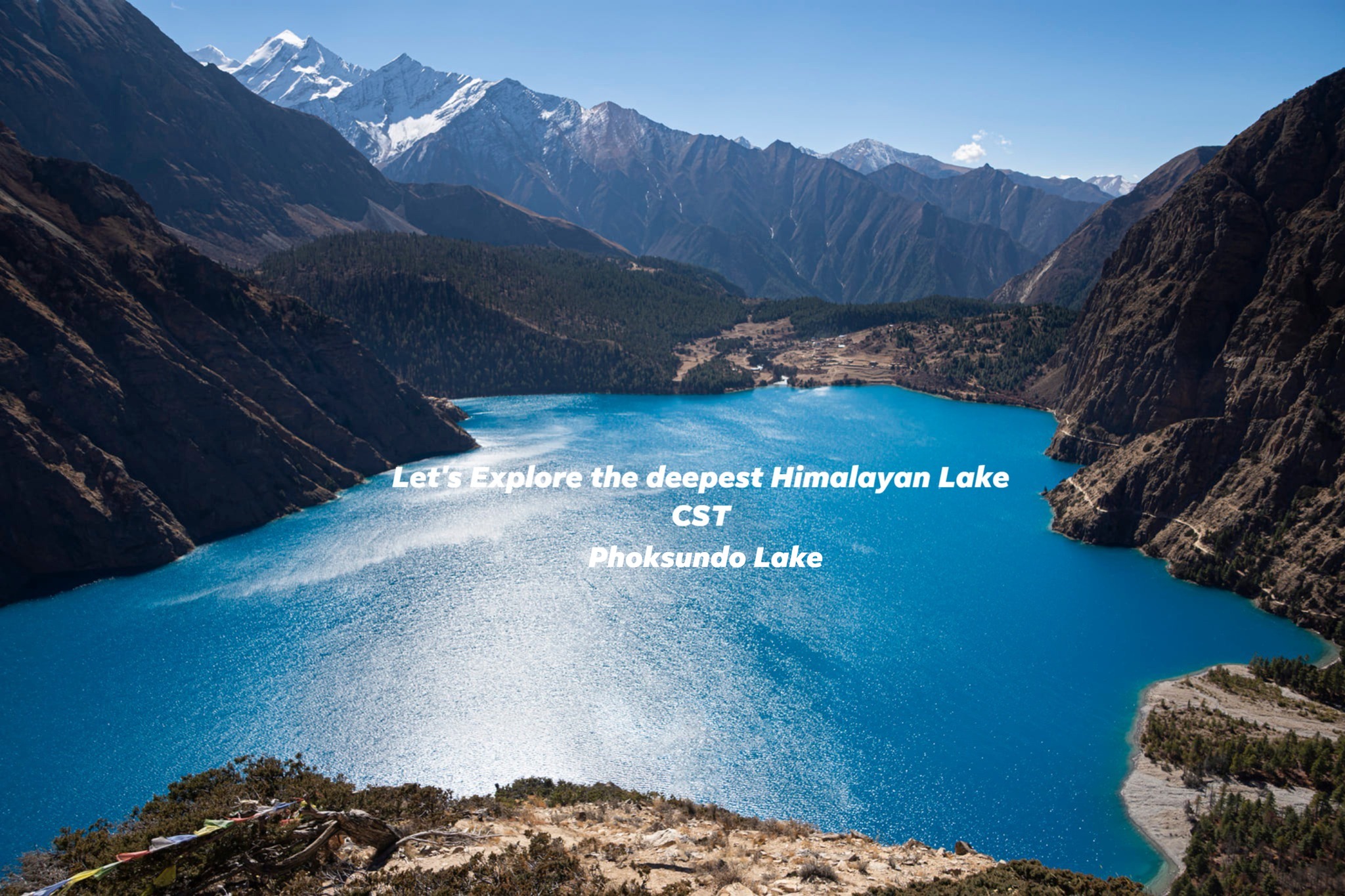
The exposure doesnot last, and the trail soon escapes the cliffs,veers north and crosses a low saddle to enter a meadowland bordered by juniper trees and blue pine .Through these trees the drains the Phoksundo Lake.At 330 metres(1083ft)it’s said to be the heighest waterfall in Nepal.A short distance beyond this,passing through a very pleasant forest ,come to a junction of trails.Across the river to the left RINGMO (3627m/11,900ft) stands in medieval isolation,guarded by kanis and chortens.Ahead lies PHOKSUNDO LAKE, a remarkable torquoise sheet of waters hemmed in by unforgiving rock walls .An airy trail skirts the western shore along a line of plunging cliffs ,and is the route to the restricted area of Shey gompo.
National Park rules forbid camping anywhere but on an official site close to the water’s edge at the south-eastern end of the lake.Whilst this may seem idyllic,reality is that the site is unbelievably result the campsite is an objectionable,unwelcoming place,and around .Few would care tospend more than one night there .What I needed is a form of compound to be built or erected in order to keep the animals out ,and the site closed for a year or so while it is sown with grass in an effort to stabilize the soil.
A short distance further along the right-hand side of the lake(15 minutes by footpath through pine forest)stands Ringmo Gompa and a line of eleven chortens.When Snellgrove visited he reported there being two Bon-po lamas and twelve monks living there .Ten years later Harka Gurung found the private chapels closed and shuttered,and in 1937 when he visited on his way to Shey Gompa,Peter Matthiessen also found the monastery locked shut and all but abandoned.But in 1995 it was lively with drums and chanting ,smiling faces and peeling murals.the gompa is said to be sixty generations old.
Ringmo village (locally known as Tso-wa,meaning ‘lakeside’)stands about one kilometer from the lake,with a wooden bridge leading across the Phoksundo Khola,which becomes the Suli Gad.The entrance kani on the Ringmo side above the bridge is fascinating and has an elaborate and beautifully decorated ceiling .Most of the village inhabitants are of Tibetan descent,and live in large,sturdy-looking stone houses with stacks of brushwood on Murwa which was seen from the Sanu Bheri trail,and Patam,the winter base which is situated further down the Suli Gad valley.Ringmo boasts a simple lodge and a shop.
As for the lake, this was formed when part of a mountain collapsed,effectively blocking the valley.The river which formerly ran through it filled the valley to considerable depths until the lake found an outlet.Local legend has a different explanation,however.
Long ago,says the legend ,a village stood where the lake nowlies,and in the eighth century Padma Sambhava,the Buddhist saint ‘Lotus Born’visited Phoksundo in order to rid the region of demons.A Bon-Po demoness tried to bribe the villagers with a priceless turquise not to dung.Assuming they had been tricked by the demoness, the villages told Padma Sambhava where she was hiding .In revenge she caused a great flood to drown the village beneath turquoise waters.
-
14: PHOKSUNDO LAKE-PUNGMO VALLEY(3770m/4-5 hours) BLD
In order to continue the route to Jumla by way of the Kagmara La, it is necessary to descend along the Suli Gad to its junction with the Pungmo valley (the valley of the Dorjam Khola,or Dorjam be a lot of height to lose before entering the Pungmo valley ,and at times the trail is quite exposed.
Begin by crossing into Ringmo village,and,pasing the school, take the down –valley trail through poor meadows and between scrub and low-growing trees,before it starts to rise uphill through birch groves.Out of the trees the path continues to rise until it reaches a high point at about 3770 matres (12,369ft),with views back to Phoksundo Lake ,and steeply down onto the waterfalls whose thunder comes drifting in the breeze.Eroded cliffs line the river ,with organ pipes and caverns blasted by the wind over countless centuries.Across to the east you look directly into the Sanu Bheri valley ,while southward rhe narrow Suli Gad valley dives between the mountains.
The route descends very steeply.It’s a dusty winding trail,and on the descent you feel heartily thankful not to be ascending!shortly after reaching the foot of the main steep descent,the way leads past the few simple buildings of PALAM (3230m/10,597ft),then enjoys a gentle section among trees and shrubs before sloping down once more to the National Park headquarters buildings of SUMDUWA,where permits will need to be checked.
Below Sumduwa the valley narrows to a wooden gorge with the trail remaining on the right bank twisting pine and juniper,often down at river –level.It’s a fine stretch ,especially on a warm day when the sun draws fragrance from the trees.A wooden footbridge over the Suli gad marks a major trail junction.across on the east bank one trail climbs upstream to Murwa and the Sanu Bheri valley,while another goes downstream to Rohagaon and dunai in two days.(It was near here that Peter Matthiessen glimpsed something he hints may have been a yeti.)Our route remains on the west bank and soon climbs steeply in to the mouth of the Pungmo valley where there is a Nepalese Army camp(about 2 ½ hours from Phoksundo Lake.)
The trail continues up-valley ,now heading north-west on the right bank of the Pungmo(or Dorjam)Khola among plenty of vegetation,the trail rising steadily.When the valley forks remain with the right –hand branch (the left branch has a trail leading to a gompa described by Snellgrove).At first this section of valley is a narrow wedge,but it soon begins to open out as you approach PUNGMO(3304m/10,840ft)
Entering Pungmo through a decorated kani and past several chortans,there is an apple orchard on the right.In the autumn trekking season ,delicious apples may be bought from the villagers,while further up-valley apricots will be seen growing.Pungmo is an attractive ,sturdy village,some of whose houses are thre storeys high and made even higher when harvest produce is stacked upon the roofs.
The trail climbs through the village and out among fields outlined with drystone walls,and in half an hour or so to a second village ,much smaller than Pungmo.This is DOJU,a haphazard collection of houses surrounded by more fields.Above this the way rises among trees and shrubs and then crosses a tributary stream which allows a brief snatched glimpse through a rocky cleft to one of the peaks of the Kanjelaruwa massif.(this mountain is variously known as Kanchen Ruwa or Kanjirolba;6612m/21,693 ft)
On coming to a lovely high meadow at about 3700 metres (12,139ft) with a solitary building in a walled compound at its upper end the valley appears to be blocked ahead by a beautiful,wedge-shaped peak.If the Mandala map is to be believed ,this is Kang chunne (6443m),but from its appearance it ought to be wedge Peak (6139m).views back down –valley are also fine to snow Peak that wall the Sanu Bheri valley.this meadow would make a perfect campsite,with water from the river only a couple of minutes away.Note that about ten minutes or so beyond here,on the opposite bank of the river,the Kagmara trail comes to another possible campsite.That site would be the last opportunity to camp for several hours.
-
15: PUNGMO VALLEY-LASA MEADOW (4300m/4-5 hours) BLD
Just above the camp the valley forks.The Kagmara La route leads through the left branch,a tight gorge-like glen in its lower reaches where it’s possible to see blue sheep.The route is a long ,steady uphill climb with tremendous views behind ,before gaining the Lasa meadows at the foot of the Kagmara La.
From the camping meadow near the head of the Pungmo valley follow the trail sloping down through trees to the riverside, and cross by the wooden bridge at 3664 metres(12,021 ft).The trail eases upstream and about 30 minutes from camp comes to a chorten at the confluence of two streams.Now the way veers left into the Julung gorge and begins the long climb.As you gain height so the steep right-hand wall of the gorge shows huge undercut slabs,while the left side is less severe with slopes carpeted with shrubs.At around 4000 metres there’s a band of rhododendrons.
Although Wedge Peak is no longer seen, looking back the mass of Kanjelaruwa becomes more and more dominant-a long crest of snow peaks soaring above the valley.Ahead the jungle valley divides with another fine snow peak heading the right –hand glen.we,however remain with the left branch.Topping a high point at about 4100 metres 913,451ft) the trail emerges from the gorge onto a rolling moorland area.At the far end of this a small apring of water will be found,but the trail climbswell above it on a rising traverse to enter the upper section of valley;a high trough coming down from a rim of glaciers and snow mountains of the Kagmara massif.
This is the area known as LASA MEADOW (about 4300m/14,108ft).A lovely area of undulating meadowland with the infant Julung Khola nearby ,Kagmara I at the head of the valley ,while downstreams ,its massive face plunging into the unseen depths of the Julung gorge,Kang Chunne(?) dominates the scene.
-
16: LASA MEADOW-GARPUNG KHOLA VALLEY(4000m/ 4 ½ hours) BLD
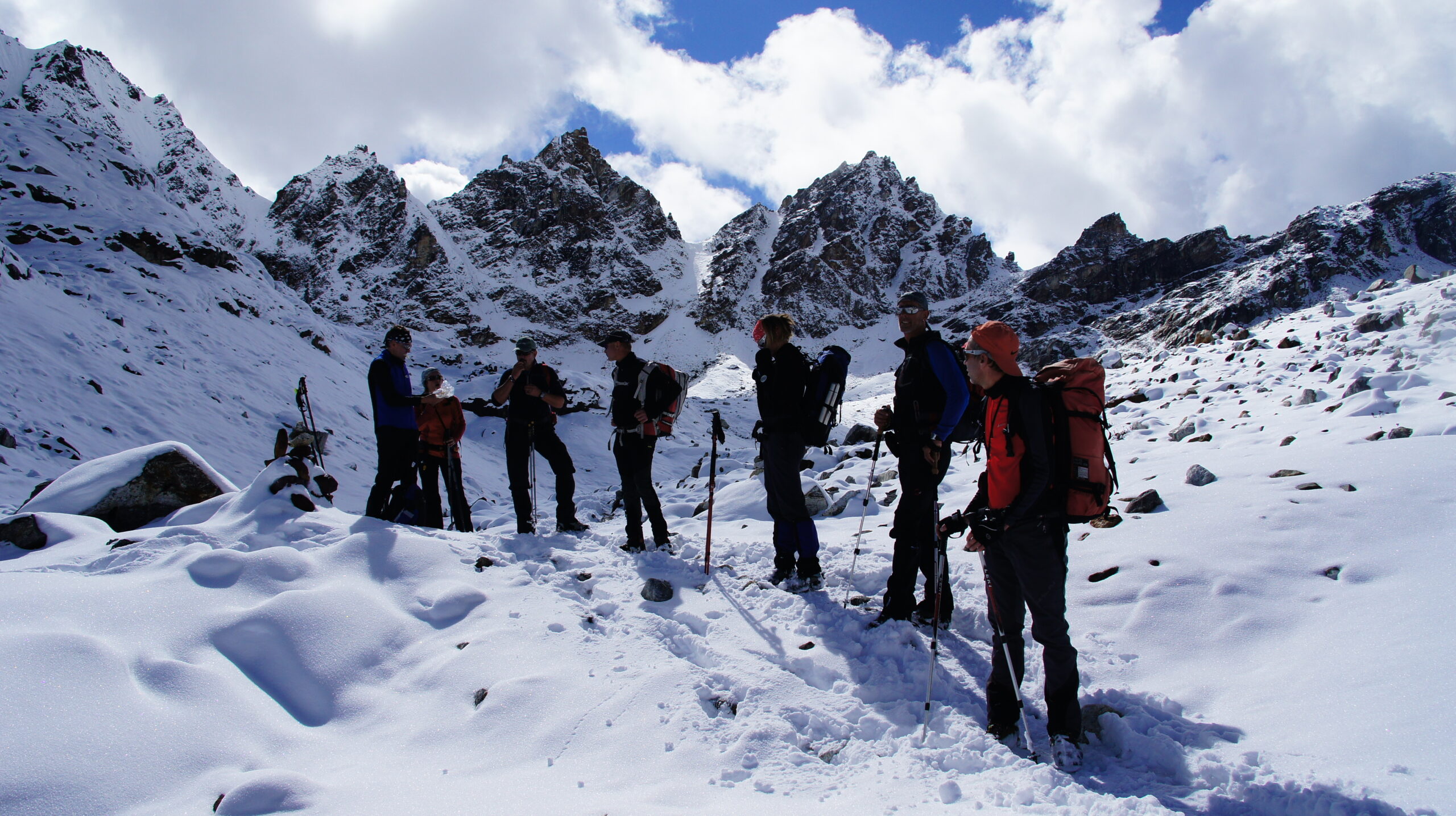
Crossing the Kagmara La under normal clear conditions should present no problems to acclimatized trekkers.the route is well –trodden and regularly used by Dolpo-pa traders with their yak trains.
Begin by working towards the hea of the valley to find a way across the Julung stream, and then follow a trail which zigzags up an obvious cone leading to a brief level of pasture.After this the trail winds on,now veering westward and steadily gaining height with magnificient views all the while.The KAGMARA LA is not seen until shortly before you reach it.Kagmara means ‘crow’s death’ or ‘crow killer’.It’s a wide open ,wind-scuffed saddle at 5115 metres(16,781ft) marked by the expected pile of rocks and a cluster of prayer flags and gained about two hours from Lasa Meadow .Kagmara I and its neighbouring peaks loom to the left with their glaciers pouring down –valley among long walls of moraine.In the far distance snow-free mountains fill the horizon,while the Kanjiriba massif is off to the north-north-west.
Descent is quite steep at first, but it eases to a brief shelf on the edge of the glacial moraine before dropping steeply again over endless moraine spills (very tiring for the knees) until you come to the left-hand side of the head of the Garpung Khola valley.a rough, stony trail skirts the left-hand side of the valley; sometimes in the vary bed of the valley, sometimes edging above a small gorge,then rounding a spur views show right along the valley’s shaft while above to the left snow and ice peaks make a sparkling wall.Coming over a grassy bluff starred with edelweiss in October,the trail drops to a good level camping area close to the river at about 4000 metres (13,123ft)
-
17: GARPUNG KHOLA VALLEY-HURIKOT (2600m/5-6 hours) BLD
This stage of the trek leads mountains and down to warmer,more heavily vegetated country.It begins by following a rough trail down the left bank of the Garpung Khola ,initially crossing several side streams,then climbing a little before descending quite steeply in places over broken ground and old landslips.Sometimes the valley takes on a brief gorge –like character where the trail picks a way through shadows,but in about an hour and a half from camp you come to a bridge of logs and stone slabs(about 3650m/11,975ft)and cross to the right bank.
The valley is much more colourful here, with lots of aromatic plants and later, plenty of trees.the trail follows a switchback course along the steep-sided hills. Berberis, cotoneaster and cannabis cover swathes of hillside,with alpine asters on more open patches of meadow.Ahead the valley of the Jagdula Khola slices across the mouth of the Garpung Khola,and as this confluence draws near ,so the continuing trail to Hurikot can be seen on the far side.Now the way cuts round a vegetated spur and begins to descend to the Jagdula Khola through lovely mixed forest ,arriving at the TOIJEM army check-post(2920m/9580ft) after 3 hours.
Just below the check-post cross the Jagdula Khola on a natural bridge of huge boulders and old landslip material, and climb steeplyon the west bank through forest to a crossing trail.Bear left among walnut trees and soon emerge from the forest to gain views back through the Garpung Khola’s valley to one of the Kagmara peaks (kagmara V?).Shortly after this you come to a national park check-post9about 20 minutes from Toijem)
Remaining high above tha milky-blue river, the trail continues its switshback course,mostly among trees or shrubs ,until about 1 ½ hours from Toijem it slopes down to river level and the first cultivated fields since Pungmo.But the trail refuses to stay in the valley bed and is soon forced to climb a little and then ,rounding a spur, Hurikot 2600m/8530ft0 is seen below;a collection of somber grey,flat-roofed houses spread in a sheltered basin of land at the junction of two valleys.Harka Gurung passed through here in the spring of 1966 on his way up-valley in Vignettes of Nepal; “Hurikot village had 22 houses mainly of Rokaya and Burathoki,including 5 of blacksmiths and 3 Byaanis.”Camping is possible in a patch of land next to the gompa,which is found on the west side of the tributary stream whose waters are harnessed to power several small mills.
-
18: HURIKOT-FOREST CAMP (3250m/5 hours) BLD
On this stage it is necessary to choose which of two pass crossings should be adopted to gain the valley of the Churta Khola.Of theses the northern and higher option is by way of the Barharla Lagna9also known as the Barbaria La; 4284m/14,055ft0,the alternativa being the Mauria Bhanjyang (3280m/12,533ft0.The first is said to offer splendid views of Mata tumpa,but the Mauria Bhanjyang also enjoys a fine panorama,with distant dhaulagiri seen on the approach to it,while the route passes through several villages.The Mauria Bhanjyang trail is described here.
The trail passes above the gompa and slants easily along the hillside above the right bank of the Jagdula Khola .In a littla under half an hour it brings you to a flag-bedecked bridge leading across the iver to KAIGAON (2650m/8694ft0.there is no need to cross to the village unless you wish to take advantage of its shop-the first since Ringmo.There are also one or two simple lodges.This is a major junction of trails ,for one goes through Kaigaon and climbs to the Balagra La(3760m/12,336ft) and then down to Tibrikot and Dunai in two days from here,while ours continue on the right bank of the river.
Just beyond the bridge pass a large school and dormitory complex,and come to a police check-post where permit details will need to be registered .the way now climbs through terraced fields and among trees and rempant shrubs;the trail becomes stony and is guided by overgrown drystone walls leading to the untidy Chhetri village of MAJGAON(2915m/9564ft),whose square is protected by a well-carved dok-pa effigy and crowded with children.(We learnt that in three neighbouring houses there were no less than 22 children!)Along with several other villages lodged along this fertile hillside,Majgaon comes under the auspices of RIMI development council.Although they enjoy an agreeable climate ,have plenty of cattle,sheep,goats and buffalo,are surrounded by fertile land and lots of streams to irrigate their fields,the villagers appear to lack even themost basic standards of cleanliness or hygiene which would suggest a condition of dire poverty.
Some 20 minutes from Majgaon the trail leads to JHARKOT.Beyond this pass the first chautaaras of the trek.the route curves into a wooden indent with a stream flowing down through stands of bamboo,then rises to an open grssy saddle on a hillside spur at 3135 metres 910,285ft),about an hour from Jharkot.(If only there were water here,this would make a wonderful campsite.)From this saddle views back through the valley of the Jagdula Khola are very fine.One of the outliers of the Kagmara massif signals far off;the route over the Balangra L can be seen to the south-east,while ahead,across a hillside bowl,chaumrikot appears a short walk away.It will take at least 45 minutes to reach it.
Now tha trail eases round thehillside, soon among dense woods of holly oak,bamboo and tree juniper,long tatters of green lichen dangling fron their branches.Losing height the way suddenly plunges on a stone stairway,at the foot of whose two logs form a bridge across a tributary stream.Over this a steep climb eventually brings you out of the trees to a mani wall,and soon after comes to CHAURIKOT (3110m/10,203ft),a medium sized Khampa village enjoying a lovely produce ,and several houses have tall drying racks on their roofs formaize cobs.
The onward trail follows a drystone wall on a scenic course with the river winding far below,like a thin pale-green ribbon at the foot of snowless mountains.Pass another small settlement then top another rise on a grassy spur before heading into forest of pine,holly,oak and yew.the undulating trail crosses several minor streams in this forest,but just beyond one of these there is an open slope of grassland between two dense belts of forest at about 3250 metres(10,663ft).although not perfect ,it makes a reasonable campsite.there are monkeys in the forest.
-
19: FOREST CAMP-CHURTA (3010m/ 5 hours) BLD
The final of the trek will be crossed about two hours from the forest camp.It’s a lovely walk ,as is the descent on the far side.In fact this is a very pleasant stage throughout.
From the open grassland the trail very quickly returns to forest and weaves its way between trees,gaining height in zig-zags until emerging to big views of blue ridges folding one into another as far as the eye can see.Over more open hillside now the way climbs steadily to top a ridge-spur marked by two chortens.From this point a broad panorama shows Dhaulagiri way off to the south-east,while countless other mountains and ridges lie confused above barely-hinted valleys.
From this ridge-spur the trail becomes a gentle belvedere,which could be dangerous under snow,contouring round to a second crest and continuing from there to tha MAURIA BHANJYANG (3820m/12,533ft)-the ‘bee’,or ‘honey pass’.This grass –covered saddle makes a superb excuse for a long rest.Ahead ,beyond lesser ranges,the great snow block of Saipal draws the eye,while much closer to the north-east the shapely trio of Dudu Kundari,Gutumpa and Mata Tumpa rise above the brown hills of the Jagdula Lekh.Just below the pass spreads a great bank of rhododendrons.
Descend among the rhododendrons and into a forest of birch,pine and oak to cross the boisterous Churta Khola at a good lunch spot.the way continues easily along the right of the river,still in forest shade but the trees more spacious as you progress,and with an occasional open meadow.Then out of forest to a large open an occasional open meadow.then out of forest to a large open meadowland where the settlement of NAPHUKANA (3080m/10,105ft)and its gompa all festooned with prayer flags can be seen to the right.About 15-20 minutes later Churta (also known as Chorta ,and sometimes Naphukana;3010m/9875ft)a Tibetan village of perhaps a dozen houses.
Just beyond Churta the trail slopes down towards the river and forks.The upper path goes to Jumla by way of the Leti Lagna and Dillichaur,but ours is the lower trail which crosses the river and follows it downstream,now on the left bank.there are plenty of good campsite along here,especially just opposite the few houses of CHANGRIKOT seen on the north bank.
-
20: CHURTA –JUMLA(2370m/6-7 hours) BLD
This ,the final stage of the Dolpo trek,retains interest until Jumla itself is reached.There are two options,both of which will be outlined.
Stay with the left bank of the river forabout one hour.Just before coming to a bridge a simple mill is seen on the opposite bank.Cross to the right bank and in another 15-20 minutes come to MANI SANGU (2775m/9104ft),a small settlement with a shop at a junction of valleys.Ignore the bridge over the river and remain on the right bank,now heading north-west into the valley of the Bapila Khola.This is an open,flat-bottomed and pastoral valley that makes for easy walking.In about 45 minutes from Manisangu cross a wooden cantilever bridge to the west bank.Just beyond this a leat has been guided to power another mill.The valley forks and you come to yet another bridge where we have a choice of routes to consider.First the more direct option via Gothichaur.
To Jumla via Gothichaur:
Do noy cross this bridge but bear left into the narrow valley of the Gothichaur Khola,then in 15 minutes cross to the north bank at a little island where there are several mills.this is KURI SANGTA.Emerging from the valley narrows the trail takes you above the GOTHICHAUR SHEEP-BREEDING STATION,shown on the Mandala map as a village,rather than just a farm,and climbs to the PATTYATA PASS (about 2850m/9350ft).the trail eases through another pastoral glen,and about one hour from the pass comes to GARJYAKOT where it is joined by another trail from the right.This is the alternative route described below,coming by way of Gothigaon.
-
21: Jumla – Nepalgunj fly (30 min) then connecting flight to Kathmandu on same day
We will take our early morning flight from Jumla to Nepaljung then connection flight to Kathmandu on same day.
-
22: Kathmandu free day of your own.(This day can be used in case flight cancellation.)
This is the free day and you can use it for your shopping .In the evening we will drive you for farewell dinner with cultural dance.
-
23: Final departure
All too soon it’s time to bid Nepal farewell and one realizes that we can never be intimate, only acquainted with this amazing adventure kingdom.
Tour Accomodation
What's Included
- Arrival and departure transfers as per itinerary.
- Twin sharing accommodation in Kathmandu in two star to 3 star hotel with b'fast as per itinerary.
- Kathmandu/Nepalgunj / Kathmandu private transportation/flight tkt
- Nepalgunj /Jhupal flight ticket for member & nepali staff
- Jumla/Nepalgunj flight ticket for member & Nepali staff
- Kathmandu sightseeing with English speaking guide.
- All entrance fee during sightseeing
- All 3 meals and accommodation while on the camping trek.
- Fully escorted trewith English speaking guide, experienced cook, sherpas and porters.
- Tents, mattress, sleeping bag, cooking utensils and other necessary camping materials.
- Wages, equipment, insurance and other facilities to staffs.
- First Aid Kit
- Lower Dolpa special permit, National park fee
- Travel Evacuations arrangement through your insurance policy in case of emergency
- Farewell dinner
- Trip Success Certificate
- International Airfare
- Nepal Visa fee (US $ 40 per person for one month)
- Airport Departure taxes/Excess baggage charges.
- Lunch/Dinner in Kathmandu and Nepalgunj.
- Travel Insurance
- Medical evacuation in case of emergency.
- Personal spending money.
- Items of personal nature i.e. Soft/hard drinks, tips etc.
- Expenses incurred due to mishaps, landslide, strikes, political unrest etc. In such case extra will be charged as per actual.
Availability
| Start | End | Status | Price | |
| March 1, 2026 | March 23, 2026 | Available | USD $2150.00 to USD $2700.00 Per person | Book Now |
| April 2, 2026 | April 24, 2026 | Available | USD $2150.00 to USD $2700.00 Per person | Book Now |
| May 1, 2026 | May 23, 2026 | Available | USD $2150.00 to USD $2700.00 Per person | Book Now |
| September 8, 2025 | September 30, 2026 | Available | USD $2150.00 to USD $2700.00 Per person | Book Now |
| October 1, 2026 | October 23, 2026 | Available | USD $2150.00 to USD $2700.00 Per person | Book Now |
| November 1, 2026 | November 23, 2026 | Available | USD $2150.00 to USD $2700.00 Per person | Book Now |
FAQ
-
What is the best time to undertake Lower Dolpo Trek?
he ideal trekking seasons are spring (March to May) and autumn (September to November) when weather conditions are favorable and skies are clear.
-
How physically challenging is Lower Dolpo Trek?
Lower Dolpo Trek is moderately challenging, requiring a good level of fitness and stamina. Regular exercise and preparation are recommended.
-
Is altitude sickness a concern on Lower Dolpo Trek?
Yes, as the trek involves crossing high passes, altitude sickness can be a concern. Proper acclimatization and hydration are crucial to minimize its effects.
Related Tours
Annapurna Circuit Trek
US$ 950.00 to USD $1550.00 Per person
Learn More
Everest 3 Pass Trekking
USD $1375.00 to USD $1950.00
Learn More
Dhaulagiri Trek
USD $2150.00 to USD $2550.00
Learn More
Kanchenjunga Trekking
USD $2250.00 to USD $2950.00
Learn More